This page is for Interstates, marked by a
For
For
For
Interstates with 3-digit numbers branch off of the
2-digit interstate with their last two digits
Ex.
| Route | Map | State | Start | End | Note |
|---|---|---|---|---|---|
| 2 | 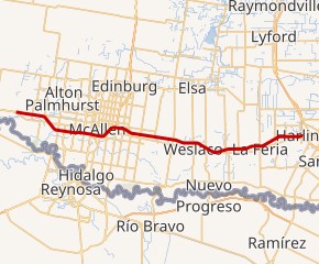 |
TX | US 83 in Peñitas, Texas | I-69E/US 77/US 83 in Harlingen, Texas | Texas only |
| 4 | 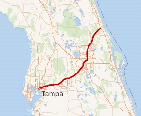 |
FL | I-275 in Tampa, Florida | I-95/SR 400 in Daytona Beach, Florida | Florida only |
| 5 | 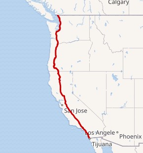 |
CA, OR, WA | Fed. 1 at Mexican border in San Ysidro, California | BC 99 at Canadian border in Blaine, Washington | |
| 8 | 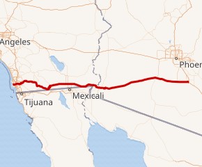 |
CA, AZ | Sunset Cliffs Boulevard/Nimitz Boulevard in San Diego, California | I-10 in Casa Grande, Arizona | |
| 10 | 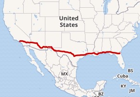 |
CA, AZ, NM, TX, LA, MS, AL, FL | SR 1 in Santa Monica, California | I-95/US 17/SR 228 in Jacksonville, Florida | |
| 11 | 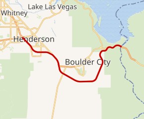 |
NV | US 93 at Arizona state line near Boulder City, Nevada | I-215/I-515/US 93/US 95/SR 564 in Henderson, Nevada | Nevada only; planned extension north and south |
| 12 | 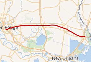 |
LA | I-10 in Baton Rouge, Louisiana | I-10/I-59 in Slidell, Louisiana | Louisiana only |
| 14 | 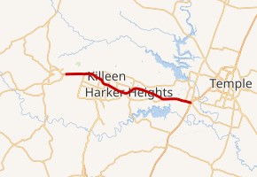 |
TX | US 190/SH 9 in Copperas Cove, Texas | I-35 in Belton, Texas | Texas only; planned extension east and west |
| 15 | 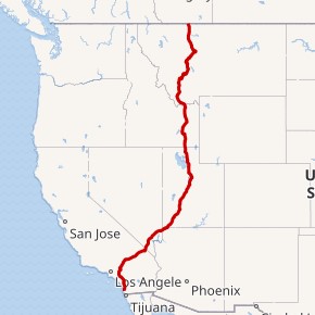 |
CA, NV, AZ, UT, ID, MT | I-8/SR 15 in San Diego, California | Hwy. 4 at Canadian border in Sweetgrass, Montana | |
| 16 | 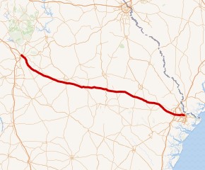 |
GA | I-75 in Macon, Georgia | SR 404 and Montgomery Street/Martin Luther King Jr. Boulevard in Savannah, Georgia | Georgia only |
| 17 | 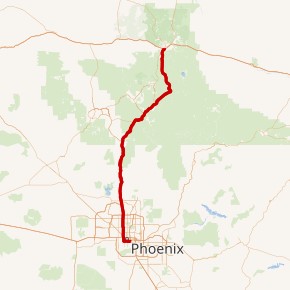 |
AZ | I-10 in Phoenix, Arizona | I-40/SR 89A in Flagstaff, Arizona | Arizona only |
| 19 | 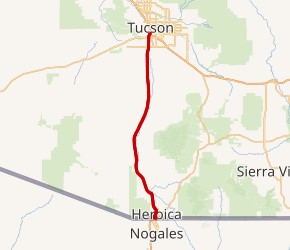 |
AZ | Fed. 15 at Mexican border in Nogales, Arizona | I-10 in Tucson, Arizona | Arizona only |
| 20 | 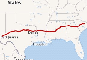 |
TX, LA, MS, AL, GA, SC | I-10 at Scroggins Draw, Texas | I-95 in Florence, South Carolina | |
| 22 |  |
MS, AL | I-269/US 78 near Byhalia, Mississippi | I-65/US 31 in Birmingham, Alabama | |
| 24 |  |
IL, KY, TN, GA | I-57 in Pulley's Mill, Illinois | I-75 in Chattanooga, Tennessee | |
| 25 | 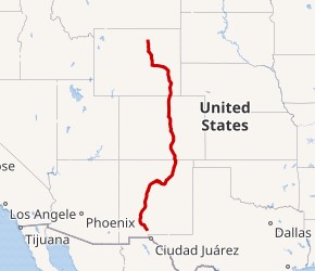 |
NM, CO, WY | I-10/US 85/US 180 in Las Cruces, New Mexico | I-90/US 87 in Buffalo, Wyoming | |
| 26 | 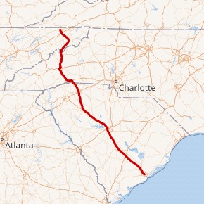 |
TN, NC, SC | US 11W/US 23 in Kingsport, Tennessee | US 17 in Charleston, South Carolina | |
| 27 | 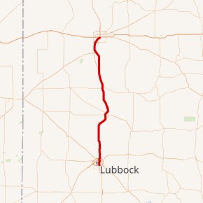 |
TX | US 87/Loop 289 in Lubbock, Texas | I-40/US 87/US 287 in Amarillo, Texas | Texas only |
| 29 | 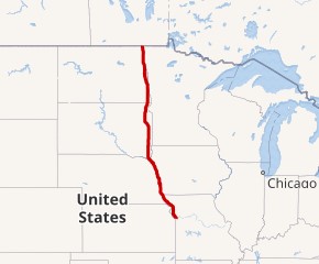 |
MO, IA, SD, ND | I-35/I-70/US 24/US 40/US 71 in Kansas City, Missouri | US 81 and PTH 75 at Canadian border in Pembina, North Dakota | |
| 30 | 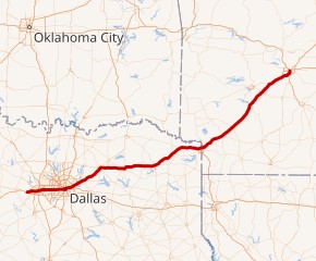 |
TX, AR | I-20 in Fort Worth, Texas | I-40/US 65/US 67/US 167 in North Little Rock, Arkansas | |
| 35 | 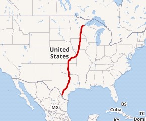 |
TX, OK, KS, MO, IA, MN | US 83/SH 359/BS I-35 and MX-85 at Mexican border in Laredo, Texas | MN 61/LSCT/26th Avenue in Duluth, Minnesota | |
| 37 | 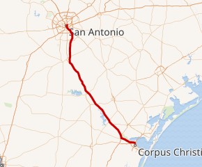 |
TX | US 181 in Corpus Christi, Texas | I-35/US 281 in San Antonio, Texas | Texas only |
| 39 | 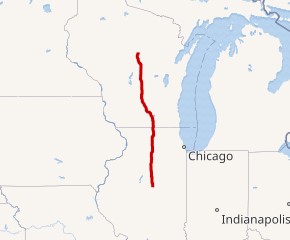 |
IL, WI | I-55 in Normal, Illinois | WIS 29/US 51 in Wausau, Wisconsin | |
| 40 | 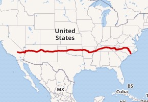 |
CA, AZ, NM, TX, OK, AR, TN, NC | I-15 in Barstow, California | US 117/NC 132 in Wilmington, North Carolina | |
| 41 | 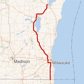 |
IL, WI | I-94/US 41 in Russell, Illinois | I-43/US 41/US 141 in Howard, Wisconsin | |
| 43 | 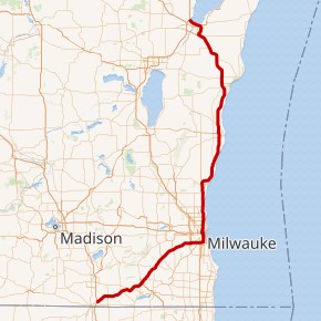 |
WI | I-39/I-90 in Beloit, Wisconsin | I-41/US 41/US 141 in Howard, Wisconsin | Wisconsin only |
| 44 | 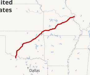 |
TX, OK, MO | US 82/US 277/US 281/US 287 in Wichita Falls, Texas | I-70 in St. Louis, Missouri | |
| 45 | 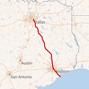 |
TX | SH 87 in Galveston, Texas | I-30/US 67/US 75 in Dallas, Texas | Texas only |
| 49 | 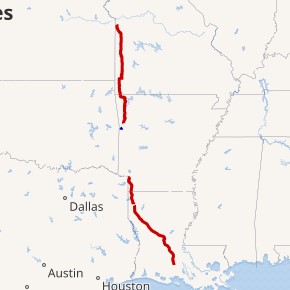 |
LA, AR, MO | I-10 in Lafayette, Louisiana | I-435/I-470/US 50/US 71 in Kansas City, Missouri | |
| 55 | 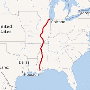 |
LA, MS, TN, AR, MO, IL | I-10 in LaPlace, Louisiana | US 41 in Chicago, Illinois | |
| 57 | 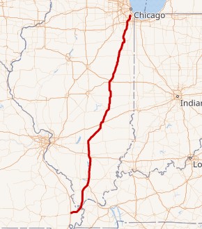 |
MO, IL | I-55 in Miner, Missouri | I-94 in Chicago, Illinois | |
| 59 | 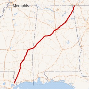 |
LA, MS, AL, GA | I-10/I-12 in Slidell, Louisiana | I-24 in Wildwood, Georgia | |
| 64 | 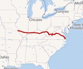 |
MO, IL, IN, KY, WV, VA | I-70/US 61 in Wentzville, Missouri | I-264/I-664 in Chesapeake, Virginia | |
| 65 | 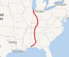 |
AL, TN, KY, IN | I-10 in Mobile, Alabama | US 12/US 20 in Gary, Indiana | |
| 66 | 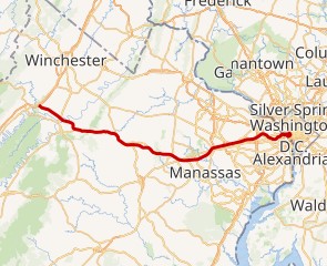 |
DC, VA | I-81 in Front Royal, Virginia | US 29 in Washington, D.C. | Serves DC and one state: Virginia |
| 68 | 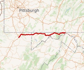 |
WV, MD | I-79 in Morgantown, West Virginia | I-70 in Hancock, Maryland | |
| 69 | 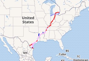 |
TX, MS, TN, IN | I-69E/US 77 & I-69W/US 59 in Victoria, Texas (future) | Hwy 402 at Canadian border in Port Huron, Michigan | Unfinished in Texas, Mississippi, Tennessee, and Indiana |
| 70 | 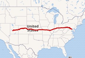 |
UT, CO, KS, MO, IL, IN, OH, WV, PA, MD | I-15 in Cove Fort, Utah | Park and ride in Baltimore, Maryland | |
| 71 | 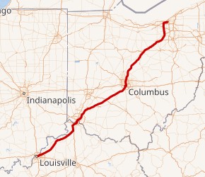 |
KY, OH | I-64 in Louisville, Kentucky | I-90 in Cleveland, Ohio | |
| 72 | 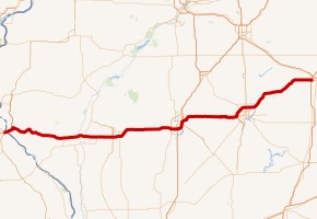 |
MO, IL | US 61 in Hannibal, Missouri | Church Street and University Avenue in Champaign, Illinois | |
| 73 |  |
NC | US 220 near Stokesdale, North Carolina | I‑74 and US 220 in Randleman, North Carolina | North Carolina only; planned extension north and south |
| 74 | 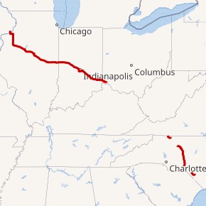 |
IA, IL, IN, OH, NC | I-80 in Bettendorf, Iowa | US 74/NC 41 near Lumberton, North Carolina | |
| 75 | 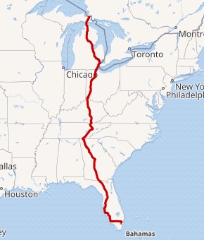 |
FL, GA, TN, KY, OH, MI | SR 826/SR 916/SR 924 in Miami Lakes, Florida | Canadian border at Sault Ste. Marie, Michigan | |
| 76a | 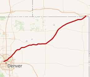 |
CO, NE | I-70 at Denver, Colorado | I-80 at Big Springs, Nebraska | |
| 76b | 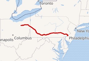 |
OH, PA, NJ | I-71 in Westfield Center, Ohio | I-295 at Bellmawr, New Jersey | |
| 77 | 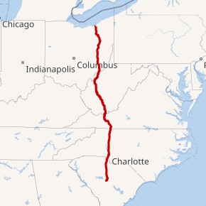 |
SC, NC, VA, WV, OH | I-26 in Columbia, South Carolina | I-90 in Cleveland, Ohio | |
| 78 | 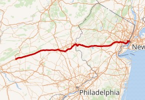 |
PA, NJ, NY | I-81 at Jonestown, Pennsylvania | Canal Street in New York City | |
| 79 | 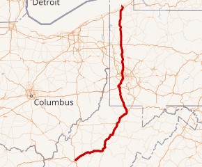 |
WV, PA | I-77 in Charleston, West Virginia | PA 5 in Erie, Pennsylvania | |
| 80 | 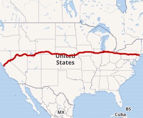 |
CA, NV, UT, WY, NE, IA, IL, IN, OH, PA, NJ | US 101 in San Francisco, California | I-95 in Teaneck, New Jersey | |
| 81 | 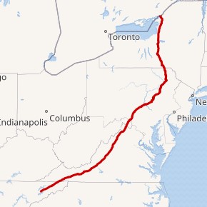 |
TN, VA, WV, MD, PA, NY | I-40 in Dandridge, Tennessee | Canadian border at Wellesley Island, New York | |
| 82 | 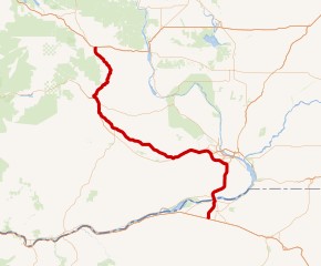 |
WA, OR | I-90 in Ellensburg, Washington | I-84 in Hermiston, Oregon | |
| 83 | 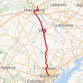 |
MD, PA | President Street and Fayette Street in Baltimore, Maryland | I-81 in Harrisburg, Pennsylvania | |
| 84a |  |
OR, ID, UT | I-5 in Portland, Oregon | I-80 in Echo, Utah | |
| 84b |  |
PA, NY, CT, MA | I-81 in Scranton, Pennsylvania | I-90 in Sturbridge, Massachusetts | |
| 85 |  |
AL, GA, SC, NC, VA | I-65 in Montgomery, Alabama | I-95 in Petersburg, Virginia | |
| 86a |  |
ID | I-84 near Declo, Idaho | I-15 in Chubbuck, Idaho | Idaho only |
| 86b |  |
NY | I-90 near North East, Pennsylvania | NY 17/NY 79 in Windsor, New York | Unfinished in New York |
| 87a | 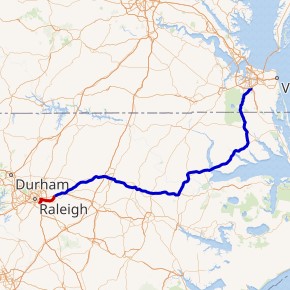 |
NC | I-440/US 64/US 264 in Raleigh, North Carolina | US 64/US 264 in Wendell, North Carolina | North Carolina only; planned northern extension |
| 87b | 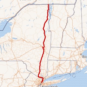 |
NY | I-278 in New York City | A-15 at Canadian border in Champlain, New York | New York only |
| 88a | 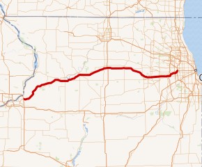 |
IL | I-80/IL 92 in East Moline, Illinois | I-290/IL 110 in Hillside, Illinois | Illinois only |
| 88b | 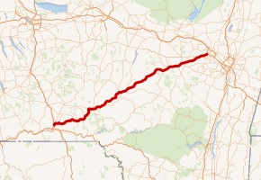 |
NY | I-81 in Binghamton, New York | I-90 in Schenectady, New York | New York only |
| 89 | 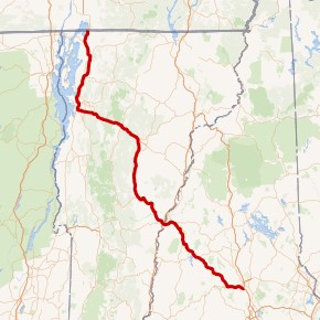 |
NH, VT | I-93/SR 3A in Bow, New Hampshire | Route 133/Future A-35 at Canadian border in Highgate, Vermont | |
| 90 | 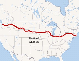 |
WA, ID, MT, WY, SD, MN, WI, IL, IN, OH, PA, NY, MA | SR 519/4th Avenue/Edgar Martinez Drive in Seattle, Washington | MA 1A in Boston, Massachusetts | |
| 91 | 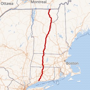 |
CT, MA, VT | I-95 in New Haven, Connecticut | A-55 at Canadian border in Derby Line, Vermont | |
| 93 | 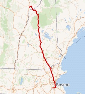 |
MA, NH, VT | I-95/US 1 in Canton, Massachusetts | I-91 in St. Johnsbury, Vermont | |
| 94 | 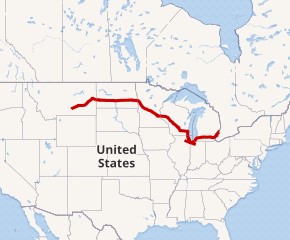 |
MT, ND, MN, WI, IL, IN, MI | I-90 in Lockwood, Montana | Highway 402 at Canadian border in Port Huron, Michigan | |
| 95 | 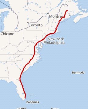 |
FL, GA, SC, NC, VA, MD, DE, PA, NJ, NY, CT, RI, MA, NH, ME | US 1 in Miami, Florida | NB 95 at Canadian border in Houlton, Maine | |
| 96 | 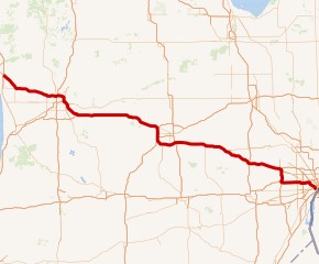 |
MI | US 31 in Norton Shores, Michigan | I-75 in Detroit, Michigan | Michigan only |
| 97 | 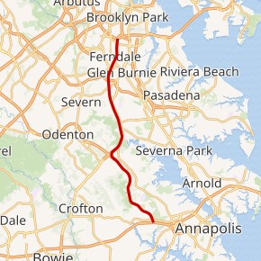 |
MD | US 50 in Annapolis, Maryland | I-695/I-895 in Glen Burnie, Maryland | Maryland only |
| 99 | 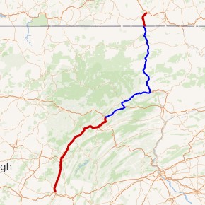 |
PA | I-70/I-76 in Bedford, Pennsylvania | I-86/NY 17 in Painted Post, New York | Unfinished in Pennsylvania |